What We Do
Keep Your Project on Track from Above
Amped Aerial provides drone-based aerial data capture and inspection services for construction sites, commercial buildings, and civil infrastructure. From weekly aerial progress photos to detailed roof condition assessments, our data gives project teams, owners, and stakeholders a clear, accurate picture of what's happening on the ground — without the cost and risk of manned aircraft or scaffolding.
We support general contractors, project managers, and property owners with consistent aerial documentation that tracks construction milestones and creates a reliable visual record for reporting, marketing, and dispute resolution. Delivery timing is confirmed as part of the project scope.
For building inspections, our high-resolution cameras capture rooftop conditions, HVAC equipment, drainage systems, and structural elements in detail that ground-level inspection simply can't match. We document what we see and deliver it to you — your licensed professional interprets and acts on the findings.
What You Receive
Aerial Progress Photos & Video
High-resolution stills and cinematic video documenting construction milestones from above.
Orthomosaic Site Maps
Georeferenced top-down site imagery for as-built documentation and planning comparison.
Volumetric Earthwork Data
Cut-and-fill calculations and stockpile volume estimates from aerial photogrammetry.
Roof Inspection Report
Annotated aerial imagery documenting rooftop conditions, defects, drainage, and equipment.
Stakeholder Progress Reports
Formatted reports with before/after imagery and milestone documentation for owners and lenders.
4K Video Walkthroughs
Cinematic aerial video tours of the site for marketing, investor presentations, and project records.
Common Applications
- Weekly construction progress documentation
- Volumetric earthwork and stockpile calculations
- As-built vs. design comparison
- Commercial rooftop inspections
- HVAC and mechanical equipment inspections
- Safety compliance monitoring
- Stakeholder and lender reporting
- Pre-purchase building condition documentation
Who We Work With
- General contractors and construction managers
- Commercial property owners
- Real estate developers
- Project owners and lenders
- HOA management companies
- Insurance adjusters
- Facilities managers
- Architects and project engineers
Sample Work
Project Gallery

Multi-building commercial development — Los Angeles, CA
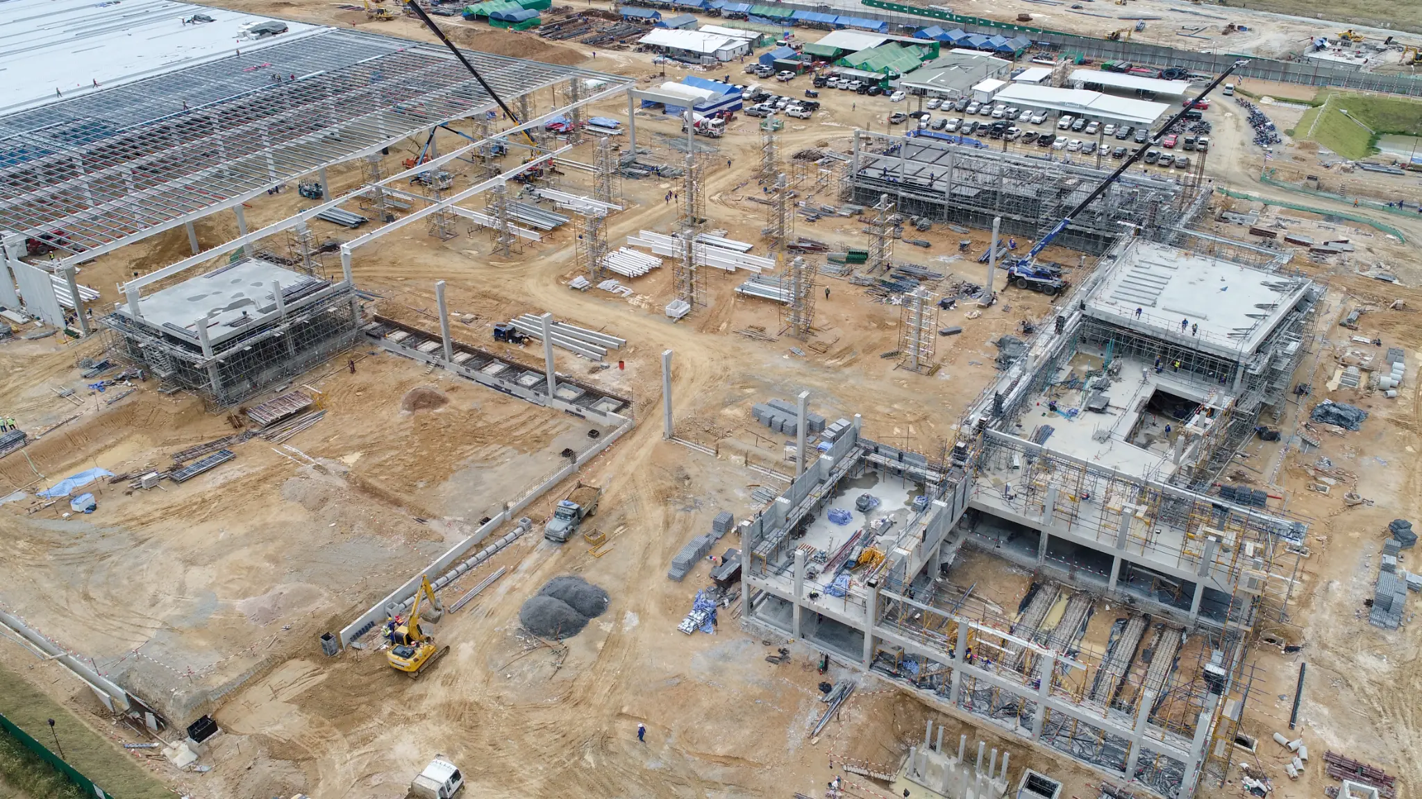
Steel structure erection — crane-assisted roof beam installation
Commercial rooftop — HVAC and mechanical equipment documentation
Distribution center flat roof — full coverage aerial inspection
Metal roof — deteriorated pipe boot penetrations identified
RGB + thermal split view — moisture zone identification
Get a Project Quote
Get a Project Quote
Tell us about your project and we’ll review the details with you. For urgent requests, call (805) 222-7858.